How Professional Geotechnical Surveys Help Reduce Construction Risks in Bali
Januari 18, 2026 | by Admin
Bali, a tropical paradise known for its breathtaking landscapes and rich cultural heritage, has become a hotspot for real estate development. However, the island’s unique geography and climate present significant challenges for construction projects. From volcanic soil to unpredictable weather patterns, builders must navigate a complex array of risks. One of the most effective ways to mitigate these risks is through professional geotechnical surveys. These surveys provide critical data that informs construction planning, ensuring the safety, stability, and longevity of structures.
Understanding the Risks in Bali’s Construction Environment
Bali is prone to natural hazards such as earthquakes, landslides, and flooding, which can severely impact construction projects. The island’s diverse terrain includes coastal areas, mountainous regions, and low-lying plains, each with its own set of geotechnical challenges. For example, sandy soils in coastal zones may require special foundation techniques, while marshy or unstable ground in hilly areas can lead to structural failures if not properly addressed.
In addition to natural risks, human factors such as poor planning, substandard materials, and inadequate site assessments can contribute to construction failures. Without proper geotechnical analysis, developers may overlook critical issues like soil erosion, water table fluctuations, or seismic activity, leading to costly delays and potential safety hazards.
The Role of Geotechnical Surveys in Risk Mitigation
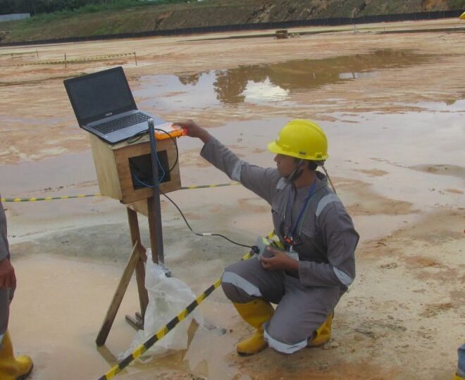
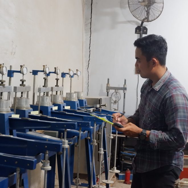
Geotechnical surveys are essential for assessing the physical properties of the ground on which a structure will be built. These surveys involve a range of testing methods, including Cone Penetration Testing (CPT) and Standard Penetration Testing (SPT), which provide detailed insights into soil composition, bearing capacity, and groundwater conditions. By understanding these factors, engineers can design foundations that are both safe and cost-effective.
Professional geotechnical surveys also help identify potential risks before construction begins. For instance, if a survey reveals that the soil is prone to liquefaction during an earthquake, engineers can implement reinforcement strategies such as deep piles or soil stabilization techniques. Similarly, if the site is at risk of flooding, drainage systems can be designed to prevent water accumulation and protect the structure from damage.
Key Benefits of Professional Geotechnical Services
- Improved Safety and Structural Integrity: Geotechnical surveys ensure that buildings are constructed on stable ground, reducing the likelihood of foundation failures, cracks, or collapses.
- Cost Savings: Identifying potential issues early in the planning phase can prevent expensive repairs or redesigns later on.
- Compliance with Regulations: Many local authorities in Bali require geotechnical reports as part of the building permit process. Professional surveys ensure that projects meet all legal and environmental standards.
- Enhanced Project Planning: Detailed geotechnical data allows for more accurate budgeting and scheduling, minimizing delays and resource wastage.
Choosing the Right Geotechnical Service Provider
Selecting a reliable geotechnical service provider is crucial for the success of any construction project in Bali. Companies like PT Anggarda Paramita Engineering specialize in conducting CPT and SPT tests, providing accurate and actionable data for developers and contractors. Their expertise in navigating Bali’s unique geological conditions ensures that clients receive tailored solutions that address specific site challenges.
When choosing a service provider, it is important to consider factors such as:
- Experience and Reputation: Look for companies with a proven track record in Bali’s construction industry.
- Technical Expertise: Ensure the provider uses advanced testing methods and has certified professionals on staff.
- Comprehensive Reporting: A good geotechnical report should include clear recommendations for foundation design, soil improvement, and risk mitigation strategies.
Case Studies and Real-World Applications

Several large-scale projects in Bali have benefited from professional geotechnical surveys. For example, a luxury hotel development in South Denpasar faced challenges due to the presence of sandy and marshy soil. Through a combination of CPT and SPT testing, engineers identified the need for deep pile foundations to ensure stability. This proactive approach saved the project from potential structural issues and ensured compliance with local regulations.
Another example involves a residential villa complex in Ubud, where geotechnical surveys revealed high groundwater levels. By incorporating proper drainage systems and using reinforced concrete slabs, the developers were able to mitigate the risk of water damage and ensure long-term durability.
Conclusion: Building a Safer Future in Bali
As Bali continues to attract investment in real estate and infrastructure, the importance of geotechnical surveys cannot be overstated. These surveys play a vital role in reducing construction risks, ensuring compliance with local regulations, and promoting sustainable development. By investing in professional geotechnical services, developers can create safer, more resilient structures that withstand the island’s natural and environmental challenges.
In a region where the stakes are high and the risks are significant, the value of expert geotechnical analysis is clear. With the right data and guidance, construction projects in Bali can thrive, contributing to the island’s growth while preserving its natural beauty and cultural heritage.

RELATED POSTS
View all

Solusi Geolistrik Terkini untuk Proyek Geothermal dan Energi Baru yang Berkelanjutan
November 22, 2025 | by Admin

Building Paradise: The Ultimate Guide to Hiring a Bali Bamboo Villa Contractor
November 29, 2025 | by Admin

How to Maximize Building Safety in Denpasar Using High-Precision SPT Data
Januari 18, 2026 | by Admin