Subsurface Cavity Detection in Denpasar: Advanced Techniques for Safe Urban Development
Mei 4, 2026 | by Admin

Subsurface cavity detection has become a critical component in ensuring the safety and sustainability of urban development projects, particularly in cities like Denpasar, Indonesia. As the city continues to expand with new infrastructure, residential areas, and commercial hubs, the need for accurate and reliable methods to identify hidden voids beneath the surface has never been more urgent. These cavities, which can form due to natural geological processes or human activities, pose significant risks to structural integrity, public safety, and long-term urban planning. Advanced techniques are now being employed to detect these subsurface anomalies, enabling engineers and planners to make informed decisions that support safe and resilient urban growth.
Importance of Subsurface Cavity Detection
The presence of subsurface cavities can lead to catastrophic consequences if left undetected. In Denpasar, where the geology includes volcanic rock formations and sedimentary layers, the risk of underground voids is heightened. These cavities may result from natural dissolution processes, such as the erosion of limestone, or from man-made factors like abandoned mines, tunnels, or improper excavation practices. Without proper detection, these hidden voids can cause ground collapse, damage to buildings, and even endanger lives. Therefore, implementing advanced detection methods is essential for mitigating such risks and ensuring the stability of new developments.
Modern Techniques for Detection

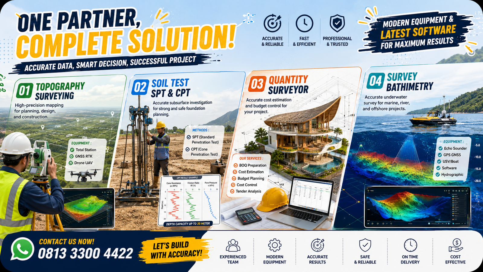
Several advanced technologies have been developed to identify subsurface cavities with high precision. One of the most widely used methods is Ground Penetrating Radar (GPR), which employs electromagnetic waves to create detailed images of the subsurface. GPR is non-invasive, fast, and capable of detecting various types of cavities, making it ideal for urban environments where minimal disruption is required. Another technique is Electrical Resistivity Tomography (ERT), which measures the electrical resistance of the soil and rock layers to identify areas with different resistivity values, often indicating the presence of voids.
In addition to these methods, LiDAR (Light Detection and Ranging) has emerged as a powerful tool for mapping surface topography and identifying potential subsurface features. By combining LiDAR data with other geophysical surveys, engineers can gain a comprehensive understanding of the subsurface conditions. Furthermore, seismic methods, such as refraction and reflection seismology, are also used to detect cavities by analyzing how seismic waves travel through different materials. These techniques provide a multi-layered approach to subsurface analysis, enhancing the accuracy and reliability of cavity detection.
Integration with Urban Planning
The integration of subsurface cavity detection into urban planning processes is crucial for sustainable development. In Denpasar, local authorities and construction companies are increasingly adopting these technologies to ensure that new projects do not interfere with existing underground structures or voids. This proactive approach allows for better site selection, improved foundation design, and the implementation of necessary mitigation strategies before construction begins. Moreover, the use of digital mapping and 3D modeling tools enables planners to visualize subsurface conditions in real-time, facilitating more efficient decision-making and reducing the likelihood of unexpected hazards during development.
Challenges and Future Directions

Despite the advancements in subsurface cavity detection, several challenges remain. The complexity of Denpasar’s geology, combined with the dense urban environment, can make it difficult to obtain clear and consistent data. Additionally, the cost of advanced technologies and the need for specialized expertise can be barriers for smaller construction firms. However, ongoing research and technological improvements are addressing these issues. For instance, the development of more affordable and user-friendly detection systems, along with the integration of artificial intelligence for data analysis, is expected to enhance the efficiency and accessibility of these methods.
Looking ahead, the collaboration between government agencies, academic institutions, and private sector stakeholders will play a vital role in advancing subsurface cavity detection in Denpasar. By investing in research, training, and infrastructure, the city can continue to develop safely while preserving its natural and cultural heritage. The future of urban development in Denpasar depends on the ability to accurately identify and manage subsurface risks, ensuring that the city grows in a way that is both innovative and secure.
RELATED POSTS
View all
Kontraktor Sumur Bor Dalam Terpercaya dan Berpengalaman di Indonesia
April 24, 2026 | by Admin

PT Anggarda Paramita Engineering: Pioneers in Soil Investigation Services in Denpasar
Januari 18, 2026 | by Admin